Walk the line
The purpose of this multi-level task is to engage students in using grid references as co-ordinates on a plane along with scales and bearings to solve a problem.
This activity assumes the students have experience in the following areas:
- Measuring angles and expressing the measure in degrees.
- Using metric units to measure length and distance.
- Applying scale factors to calculate distances from a map.
- Expressing direction as a bearing in relation to North.
The problem is sufficiently open ended to allow the students freedom of choice in their approach. It may be scaffolded with guidance that leads to a solution, and/or the students might be given the opportunity to solve the problem independently.
The example responses at the end of the resource give an indication of the kind of response to expect from students who approach the problem in particular ways.
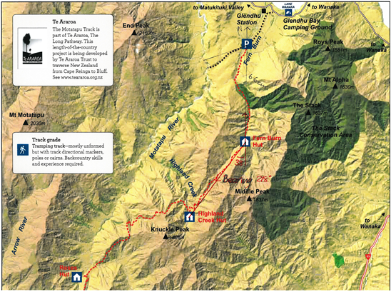
 Task: A group of outdoors enthusiasts are planning to walk the Motatapu track.
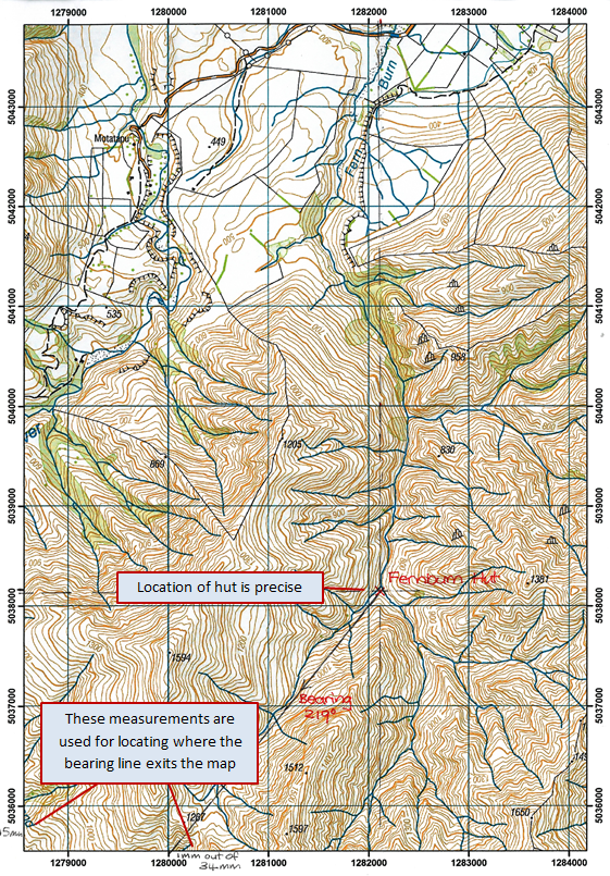
The track is clearly marked on the Department of Conservation guide, but does not appear on the topographical map. They have been advised that, while the terrain is relatively open, the track is not clearly marked between Fern Burn Hut and Highland Creek Hut.
Mark the route that follows these bearings, on the map and work out how much further the group will have to walk than is visible on the map, to get to the second hut.
The following prompts illustrate how this activity can be structured around the phases of the Mathematics Investigation Cycle.
Make sense
Introduce the problem. Allow students time to read it and discuss in pairs or small groups.
- Can I rephrase the problem in my own words?
- What resources do I need? (The guide and map need to be downloaded and a calculator and ruler made available.)
- Can I draw or sketch the situation? (The map will be useful for sketching the route.)
- What will my answer to this problem look like? (The student will provide a distance and direction (bearing) between Fern Burn and Highland Creek huts.)
Plan approach
Discuss ideas about how to solve the problem. Emphasise that, in the planning phase, you want students to say how they would solve the problem, not to actually solve it.
- What are the maths skills I need to work this out? (Interpreting scale on a map and angles is important.)
- What are sensible estimates for distance and direction, using the map?
- What strategies can I use to get started?
- What tools (digital or physical) could help my investigation?
Take action
Allow students time to work through their strategy and find a solution to the problem.
- Does my answer seem correct? Is it close to my estimation? Is the distance reasonable?
- How could I make sure that I haven’t missed anything?
- Is there another possible answer or way to solve it?
Convince yourself and others
Allow students time to check their answers and then either have them pair share with other groups or ask for volunteers to share their solution with the class.
- What is the solution?
- How does my solution answer the question?
- How do I know if I have worked this out correctly?
- Which ideas or tools worked well in my investigation?
- Is there some mathematics that I would like to be able to do that I can't do at the moment?
- How do I convince others that my findings answer the question?
Examples of work
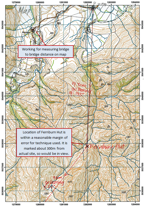
Work sample 1
The student measures lengths and angles on a map (guide), calculates the actual distances to scale, and gives a bearing, to describe a route.
Click on the image to enlarge it. Click again to close. 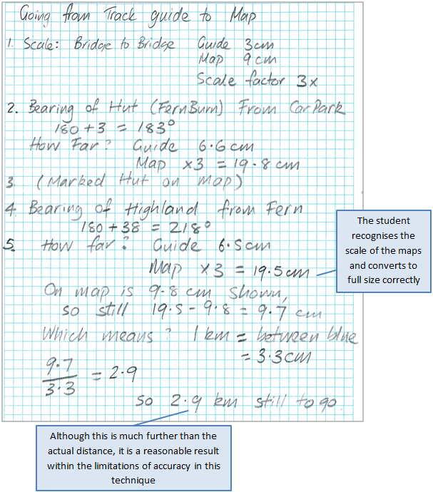
Work sample 2
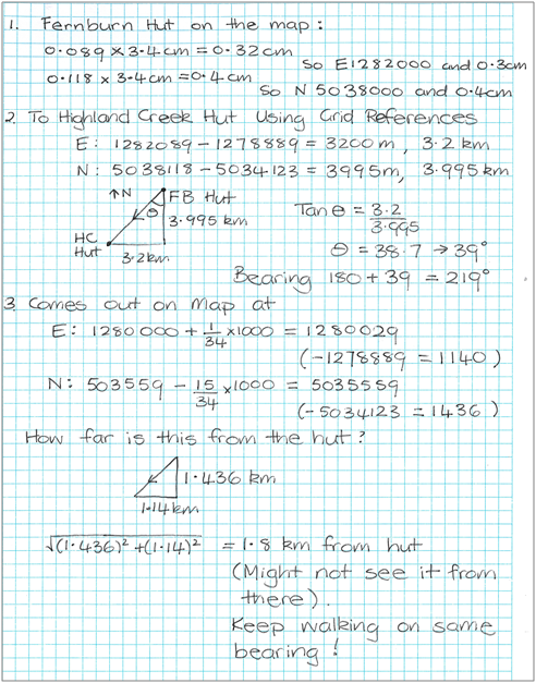
The student works with measurements and calculations of co-ordinates, to solve a problem involving maps, bearings and displacement.
Click on the image to enlarge it. Click again to close.